
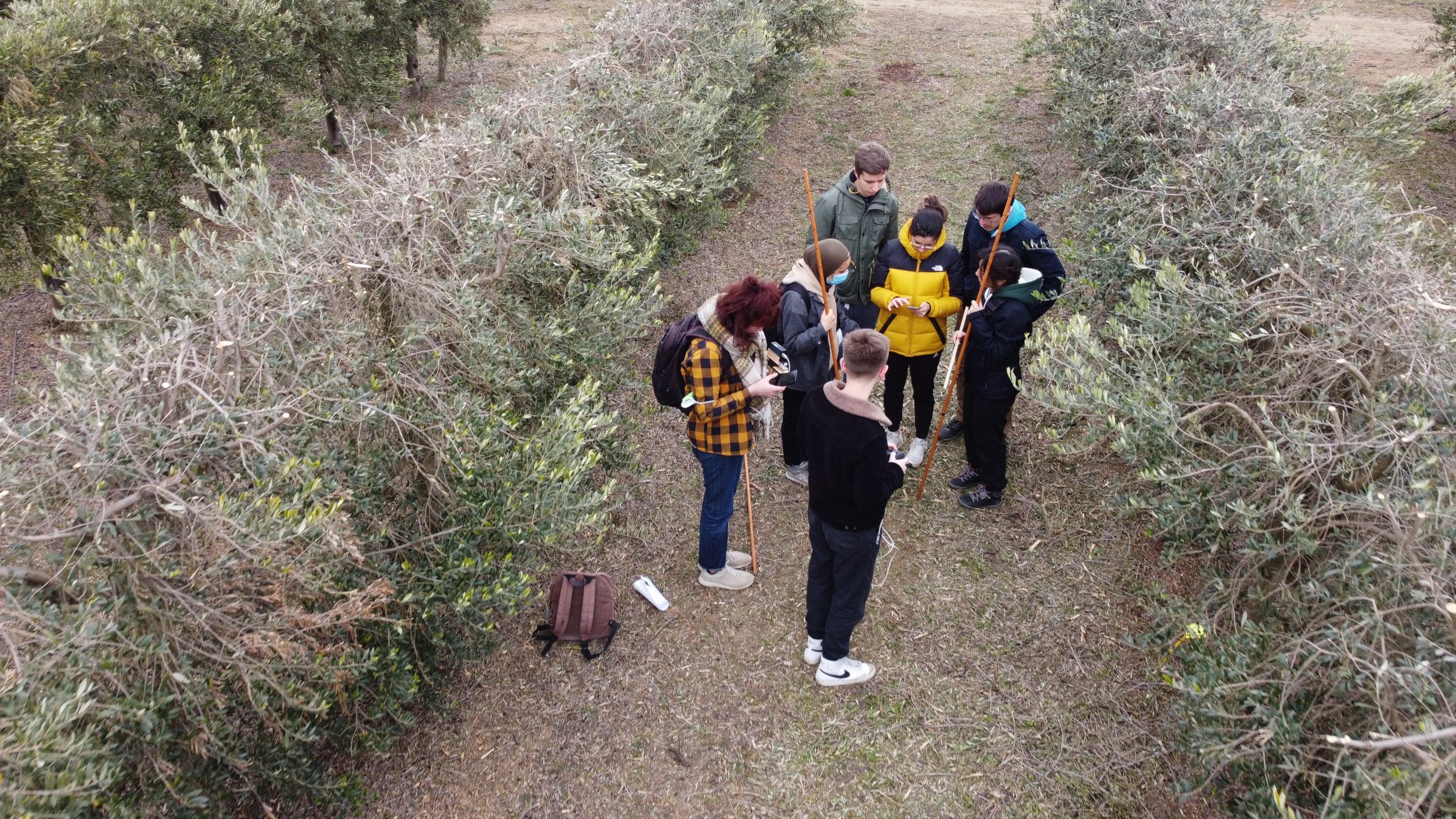
Les étudiants à l’assaut des oliviers
février 9, 2022
AgroTIC, IoT, agriculture urbaine : un vrai défi !
février 10, 2022
While cropland expansion was for a long time considered as the main strategy to increase food production across sub-Saharan Africa, it is now widely acknowledged that this strategy is not sustainable due to strong land constraints and environmental concerns (Zabel et al., 2019). In this context, the reduction of existing yield gaps on current available cropland, is considered as a promising pathway to meet the current and future food demand of an increasing population (Cassman and Grassini, 2020). Yield gap (YG) is defined as the difference between the potential yield (Yp) and the actual yield (Ya) observed in farmers’ field in a given context. Sub-saharan Africa is a region suffering from large YG mainly due to nutrient limitations resulting from inherently low soil fertility and low use of external inputs (Affholder et al., 2013).
Currently the Global Yield Gap Atlas (https://www.yieldgap.org/, GYGA) is a unique tool that provides information on the yield gaps of major crops aggregated at national, climate zone or reference weather station levels using a combination of ground data, crop model simulations and climate data at coarse spatial resolution through a bottom-up approach (Grassini et al., 2017).
Despite the huge step forward made by GYGA, several improvements are needed to up-scale location-specific estimation of the YG at a large scale while keeping sufficient levels of details to be in line with the high heterogeneity observed in the sub-Saharan Africa smallholder context. Hence the core of the improvements of the large-scale assessment of YG will rely on the use of data that are able to cover large areas while being precise enough to catch yield variability.
The main objective of the PhD research study is to assess YG at large scale for rainfed cereals in SSA using up-to-date multi-source remote sensing and recent advances in geospatial technologies while benefiting from the analytical capabilities provided by the Google Earth Engine cloud computing platform. We propose to focus on East Africa for three reasons (1) The region experiences one of the highest level of food insecurity in the continent (FAO et al., 2020), (2) whilst also suffering from the largest yield gaps in rainfed crops (Mueller et al., 2012), (3) the existence of large dataset on crop monitoring through different initiatives (e.g. TAMASA, CGIAR Bigdata Platform). First, the upscaling of location specific estimates of yield gaps to larger areas is done using a bottom-up approach based on technology extrapolation domains (TEDs) that are assumed to delineate zones that are relatively homogeneous in terms of crop and soil management options and hence where crops perform similarly (Andrade et al., 2019).
Lieu : CIRAD Montpellier
Toutes les informations pour candidater : https://recrutement.cnes.fr/fr/annonce/1497741-056-large-scale-yield-gap-estimation-with-multi-source-remote-sensing-data-34000-montpellier


